About Tellus Border Downloads

Please view Data Usage Terms and Conditions here before using this data. Geophysics meta data is also contained within this file.
To view the Geophysics processing report, please click here.

Flight Lines.zip
(10.5Mb) 
 
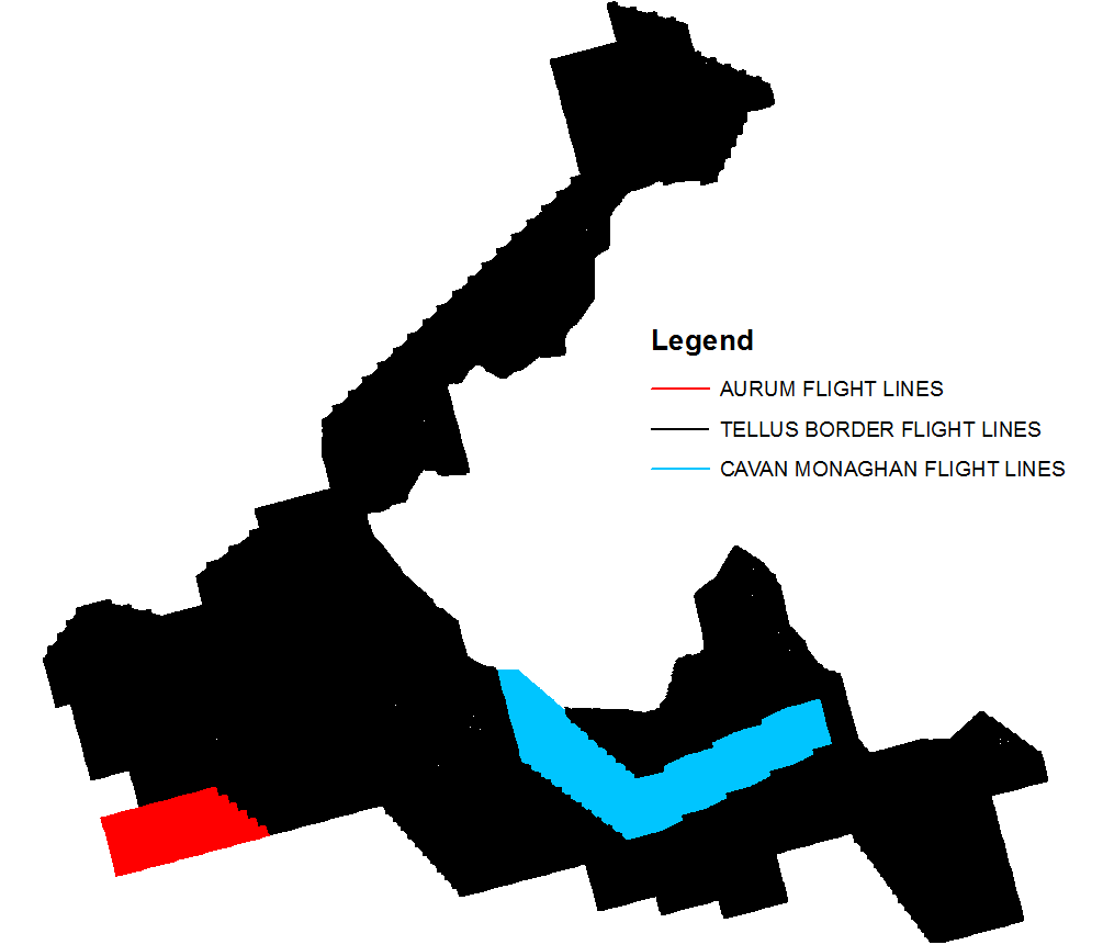
Radiometric data.zip  (34.3Mb)
 
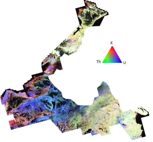
Magnetic Data.zip
(warning: large file 249Mb)


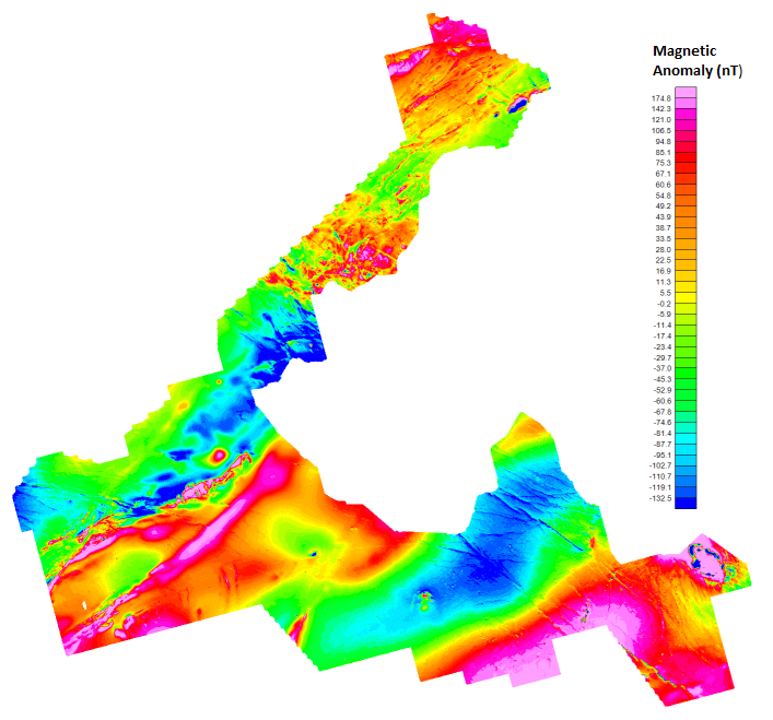
Magnetic Data by section

If the entire magnetics dataset is too big to download, it can be downloaded in sections by clicking the links below View large image


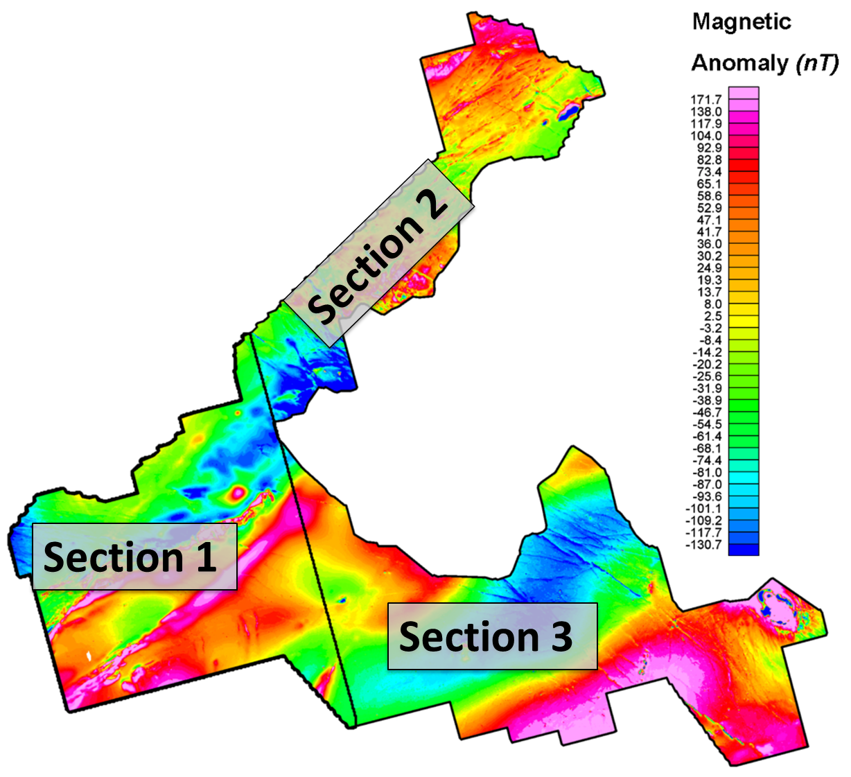
Section 1.zip(76.1 Mb)       Section 2.zip(51.6Mb)
Section 3.zip(106 Mb)         Tie Lines.zip(21.2Mb)
Electromagnetic Data.zip
(warning: large file 220 Mb)


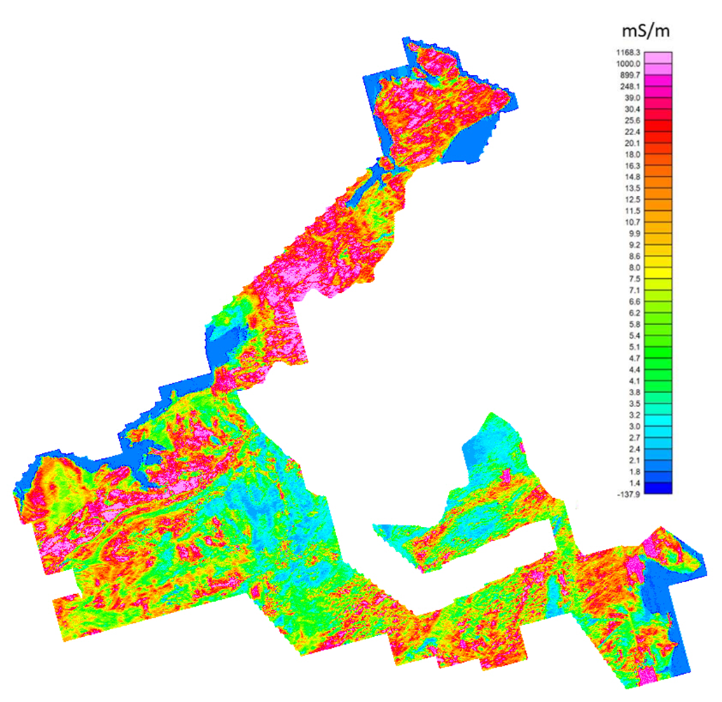
Electromagnetic Data by section

If the entire Electromagnetics dataset is too big to download, it can be downloaded in sections by clicking the links below View large image

Section 1.zip(109 Mb)       Section 2.zip(112 Mb)

GIS Web Map Services (WMS)

You can now access the Tellus Border GIS data directly through your desktop GIS application, or use it to create a live 'mash up' web service.
OGC compliant WMS (Web Map Service) feeds are now available via DCENR GIS server.
Consult your software's help documentation on how to add the WMS.
Download Opening a GSI WMS in ArcGIS.pdf

Magnetics

http://spatial.dcenr.gov.ie/arcgispg/
services/TELLUS_LIVE_PUB/
MAG_TMI_TB_CAV_TELLUS_CLIP/
ImageServer/WMSServer?

Potassium

http://spatial.dcenr.gov.ie/arcgispg/
services/TELLUS_LIVE_PUB/
RAD_K_TB_CAV_TELLUS_CLIP/
ImageServer/WMSServer?

Total Count

http://spatial.dcenr.gov.ie/arcgispg/
services/TELLUS_LIVE_PUB/
RAD_TC_TB_CAV_TELLUS_CLIP/
ImageServer/WMSServer?

Ternary

http://spatial.dcenr.gov.ie/arcgispg/
services/TELLUS_LIVE_PUB/
RAD_TERNARY_TB_CAV_TELLUS_CLIP/
ImageServer/WMSServer?

Thorium

http://spatial.dcenr.gov.ie/arcgispg/
services/TELLUS_LIVE_PUB/
RAD_TH_TB_CAV_TELLUS_CLIP/
ImageServer/WMSServer?

Uranium

http://spatial.dcenr.gov.ie/arcgispg/
services/TELLUS_LIVE_PUB/
RAD_U_TB_CAV_TELLUS_CLIP/
ImageServer/WMSServer?
Google Earth-kml files
To view these kml files below,you will need to install Google Earth.
Download Google Earth here.

Magnetics
Potassium
Thorium
Uranium
Ternary
Total_Count
ESRI ArcGIS Grids

The Geosoft plug-in for ArcGIS can be downloaded here. This will allow you to view the Geophysical data using the same colour ramps as shown in the Tellus Border viewer. The colour ramp applied to all Geophysical grids is Geosoft Clra_32 and the stretch type is Histogram Equalize. 

Magnetics
Potassium
Thorium
Uranium
Ternary
Total Count
EM High Frequency
EM Low Frequency
Note: Only Tellus Border datasets for the Republic of Ireland are available for download.
For information on licensing the Tellus Data for Northern Ireland please visit

www.bgs.ac.uk/gsni/tellus/data_licensing/index.html