1. What is Tellus Border?
Tellus Border is a survey project that mapped the rocks, soils and streams of the six northern counties of the Republic of Ireland with modern scientific methods. Survey work started in the summer of 2011 and ran until the end of 2012. The project sampled soils and streams and analysed their chemistry in great detail. At the same time a survey aircraft flew low over the landscape and collected information about the physical properties of soils and rocks.
2. Why did we need to do this survey?
The survey has given a comprehensive picture of the environment in the border region today which will help us sustainably manage the environment in the future. Data on soil, rocks and water has been compiled into maps that are made freely available. This information will be of great use to policy makers, researchers, students and private industry.
3. Where does the name “Tellus” come from?
In Roman mythology, Tellus was the goddess of the Earth. This survey aimed to measure and understand the properties of three key elements of the earth – soil, rock and water – in the border region of Ireland. The name Tellus Border was chosen to represent this holistic approach. It follows on from the first Tellus survey which was completed in Northern Ireland in 2007.
4. Is Tellus Border anything to do with fracking?
No. Tellus Border isn’t related to fracking and isn’t involved with the current shale gas exploration licensing in the border region.
5. What kind of aircraft was used in the survey?
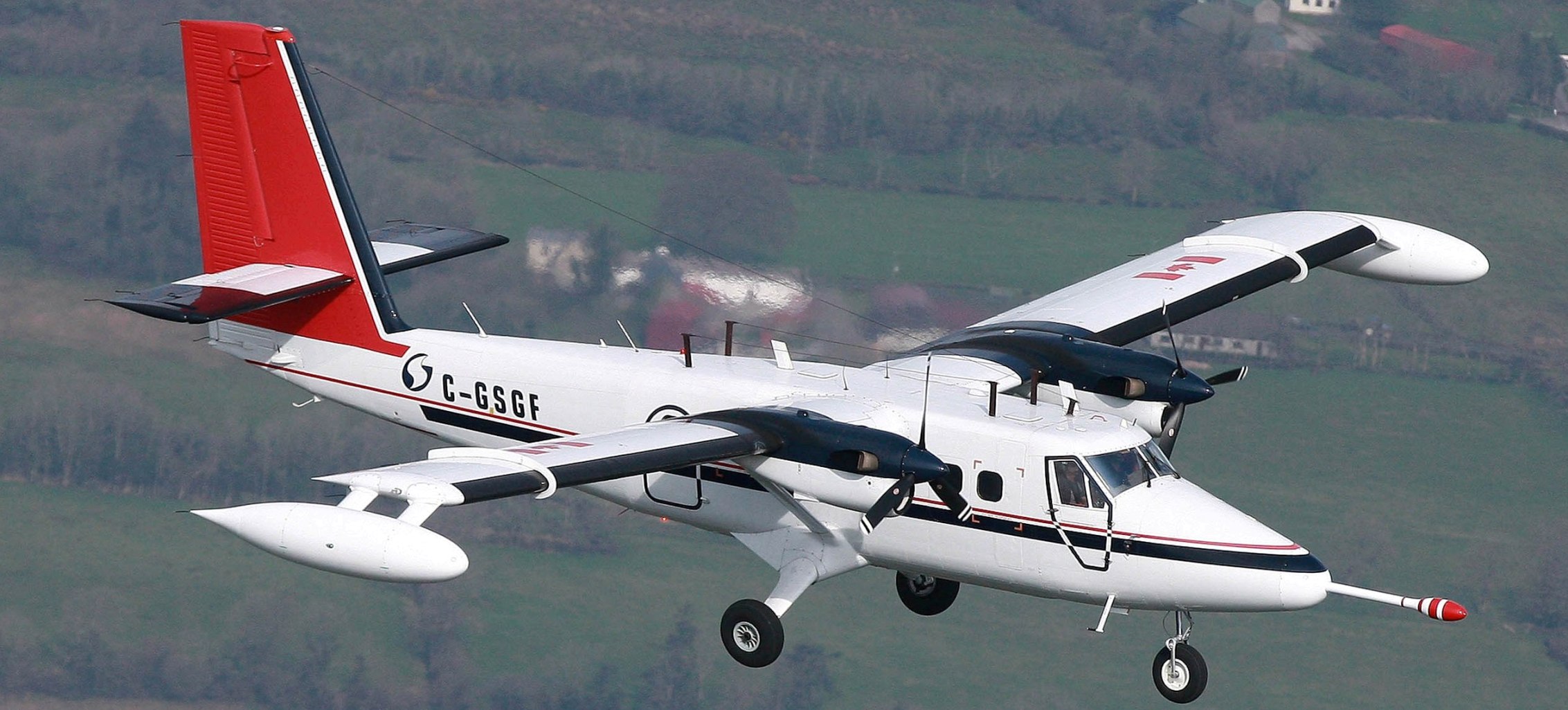
The aircraft was a Twin Otter aircraft operated by the specialist survey company, Sander Geophysics of Ottawa, Canada. The white, twin propeller plane has a red tail and blue stripe. Its registration number is C-GSGF. The aircraft was used by the Geological Survey of Northern Ireland to survey the whole of Northern Ireland in 2005 and 2006.
6. At what height and speed did the survey aircraft fly? Why did it have to fly at a low altitude?
The aircraft flew at a safe height authorised by the Irish Aviation Authority. In rural areas this was 60m – about 7-8 times the height of a two storey house. In urban areas the height was 240m. It flew at a low altitude because the instruments on board the plane can sense the properties of soil and rocks more accurately at a low altitude. The speed of the aircraft was about 130 mph, and the sound of the aircraft passing overhead was similar to that of a passing lorry.
7. What equipment was the plane carrying? What did they measure and were they dangerous?
The aircraft carried a range of instruments for navigation and for measuring geophysical properties of the ground. The navigation instruments carried on the aircraft included:
· A satellite navigation system;
· A radar altimeter for measuring altitude; and
· A video camera, which gives us a record of where the plane has flown. The video footage will not be used for any other purpose.
The geophysical instruments on board the plane comprised:
· Two electromagnetic coils which measure the electrical conductivity of soil, rocks and groundwater;
· A magnetometer which measures variations in the Earth’s magnetic field; and
· A gamma ray detector which measures the natural radioactivity of soil and rocks.
The electromagnetic coils are the only instruments which send out a signal to the earth. This is a very weak signal, equivalent to the power of a light bulb. The other instruments are passive i.e. they don’t send out any signals.
8. Where and how were the soil and water samples taken? What were the samples being analysed for? Was the survey anything to do with septic tanks?
Soil samples were taken by a team of two trained scientists using a hand auger. About 1kg of soil was taken, a similar weight and volume to that of a bag of sugar. At each stream site, three sample types were taken – water, sediment and vegetation. One soil and one stream site were sampled every 4km2 (about 1 sample every 1000 acres), which amounted to approximately 3,500 samples across the Tellus Border survey area.
The samples were analysed for up to 55 elements and compounds. The results are useful for assessing the health of the environment, agricultural nutrients and trace elements. The results aren’t intended to provide information on individual landholdings and the survey isn’t concerned with septic tanks.
9. Was my land visited during the survey?
The aircraft flew through the whole border region including Donegal, Sligo, Leitrim, Cavan, Monaghan and Louth. A two-person sampling team may have visited your land.
Sampling teams had branded clothing, vehicles, ID cards and a letter which identified them as Tellus Border workers. The survey is now complete.
10. Who was doing the work?
The project was managed by a cross-border partnership:
- Geological Survey of Ireland
- Geological Survey of Northern Ireland
- Dundalk Institute of Technology
- Queen's University, Belfast
The survey work was undertaken by qualified, highly specialised and experienced companies.
11. Who paid for this project?
Tellus Border was mainly financed by the INTERREG IVA programme of the European Regional Development Fund. The project was co-financed by the Department of Environment, Community and Local Government (RoI) and the Department of Environment (NI).
12. Where can I get more information?
You can contact us by email, phone or through our website to get more information on Tellus Border.
Website address: www.tellusborder.eu
Email address: tellusborder@gsi.ie
Information line: Freephone 1800 303 516
(028 3039 3851 from Northern Ireland).
Postal mail may be addressed to:
Mairéad Glennon,
Assistant Project Manager,
Tellus Border Project,
Geological Survey of Ireland,
Beggar's Bush,
Haddington Road,
Dublin 4,
Ireland.